Zakynthos
Zanta, Zakesna or Zakilda (Greek: Ζάκυνθος Zakynthos; Ottoman: Izakilise, Zaklise or Zante) is a Greek island in the Ionian Sea. The third largest island among the Ionian Islands, Zante is the only island in the region to have a separate municipality. It has a surface area of 405.55 square kilometers and a coastline length of approximately 123 kilometers.[1]
Thanks to the international airport on Zante, there are regular charter flights from Northern Europe and thus it has become a tourist destination. The nickname of the island is “Flower of the Eastern Mediterranean”. This title was inherited from the Venetians who ruled the island between 1484 and 1797. According to Greek mythology, Zakynthos, son of Dardanus, gave the island its name.[1]
Geography
Location and Landforms
Zakynthos 3D
Due to its location on the Ionian Sea, Zante is 20 kilometers from the Greek mainland. It is located 15 kilometers south of Kefalonia. It is also the southernmost of the Ionian Islands. Marathonisi, Peluzo, Agios Sostis, Agios Nikolaos and Agios Ioannis; They are small uninhabited islands connected to Zante. The center of the island is Zante, which goes by the same name. This place remains on the east side of the north coast. Besides its official name, it is also known by the name Chora. From the port of Zante there are ferries to Kyllini – the mainland. Another ferry line is between Agios Nikolaos and Kefalonia.
Zante is about 40 kilometers long and 20 kilometers wide. The island, which has a surface area of 405.55 square kilometers, has a coastline of 123 kilometers. According to 2011 data, 40,759 people live here. The highest point of the island is Vrachionas at 758 meters. Resembling the tip of an arrow, the western side of the island is a mountainous plateau, and its southwestern coast is mostly steep cliffs. The hills separating the eastern side of the island from the other parts of the island enabled these areas to become fertile and densely populated. At the same time, there are long beaches in the eastern parts.[1]
Plant and Animal Diversity
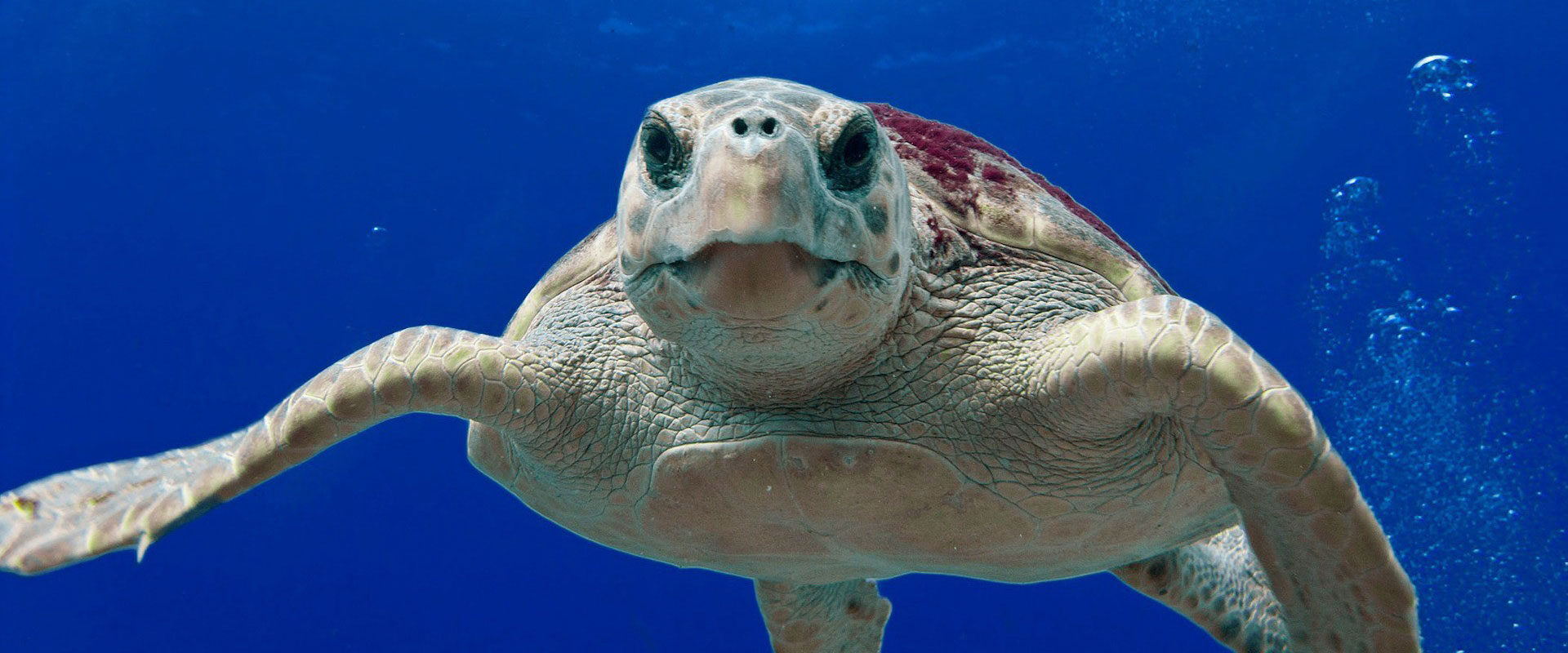
The island, which has a Mediterranean climate and receives plenty of winter precipitation, is covered with a dense vegetation. The main agricultural products are olives, grapes, citrus fruits and currants. This currant, which grows on the island, is a small and sweet stone fruit that is completely unique to this region. Laganas Bay is the main nesting site for sea turtles (Caretta caretta) in the Mediterranean.
Natural and Historical Places
Navagio Bay and Navagio Beach are located on the island’s northwest coast, isolated by high cliffs and accessible only by boat. Keri; is a mountain village with a lighthouse in the south of the island. Rock formations are found all along the west coast, from Keri to Skinari. The cliffs and stone arches of the island’s northern and eastern coasts boast numerous wide sandy beaches that attract tourists during the summer months. Marathonissi Island (also known as Turtle Island); It is famous for its tropical vegetation, turquoise waters, beaches and sea caves. There is a small Venetian castle on Bochali Hill, just above the city centre.[1]